How Drones Are Transforming Cadastral Survey Processes

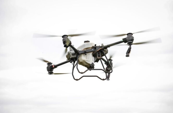
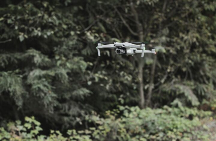
A drone flying over a landscape surveying land with high-resolution cameras and sensors.

A field that once relied on weeks of groundwork and manual measurements now looks very different: drones are reshaping how professionals conduct cadastral surveys. High-resolution cameras and advanced sensors have opened up new possibilities, offering both speed and precision that weren’t possible with traditional land surveying tools.

Faster, More Accurate Data Collection

Cadastral surveys are the backbone of property mapping and legal land boundaries. Traditional methods often require surveyors to access difficult terrain and collect thousands of points by hand. With drones used for cadastral surveys, data collection is vastly accelerated. A drone can fly over large areas in a fraction of the time, capturing detailed orthophotos and 3D models. The result: boundary lines drawn with centimeter-level accuracy and deliverables ready in days instead of weeks.

Surveillance Drones and Their Expanding Role

The surveillance drone is no longer just a tool for security or monitoring. In cadastral surveying, these drones offer unique advantages. Their onboard sensors can detect features not visible to the naked eye, and their flight patterns can be customized to suit the specific needs of each project. Whether mapping urban plots or tracking changes in rural landscapes, these drones provide high-frequency, reliable data essential for up-to-date cadastral records.

Commercial Drones Versus UAVs: What’s the Difference?

You might hear people use “UAV” (unmanned aerial vehicle) and “drone” interchangeably, but there are subtle differences in the context of land surveying. “Drone” commonly refers to the entire system, including sensors and ground control, while “UAV” is the flying airframe itself. Modern commercial drones used for cadastral and utility inspections integrate multiple payloads and software, making them more than just simple UAVs. For example, a commercial drone system might combine LIDAR, multispectral sensors, and real-time data streaming to tackle both mapping and inspection tasks in a single flight.

Innovation Behind the Scenes

Developing the technology that powers reliable drone inspection and mapping equipment requires extensive research and development. The R&D team at Acecore Technologies is a strong example of how innovation is driving the industry. They focus on improving flight stability, payload versatility, and data security, ensuring that today’s drones can handle the increasing demands of cadastral surveyors. Their work helps translate cutting-edge research into tools that are rugged enough for daily field use.

Choosing the Right Drone for Cadastral Work

Selecting a drone system for cadastral surveys involves balancing several criteria:

  • Accuracy of the onboard GNSS and camera systems
  • Flight time and coverage area per battery cycle
  • Compatibility with post-processing software for mapping
  • Durability and weather resistance for field conditions

For utility inspection or drone security roles, payload flexibility and data encryption also play bigger roles. Evaluating these features based on the specific needs of your projects is essential to getting the most value from your investment.

Where to Learn More About Professional Drone Surveying

For those interested in expanding their knowledge or taking their drone surveying practice further, resources on advanced mapping techniques and updates in drone regulations can provide the next step. Guides on commercial drone applications or insights from the R&D team at Acecore Technologies are especially valuable for staying at the forefront of this fast-changing field. Consider exploring an in-depth guide to drone mapping workflows or attending industry seminars to deepen your expertise.

Continue Reading

Effective Forestry Mapping Techniques with UAVs

Aerial view of a dense forest with a UAV capturing data for forestry mapping.

Forestry management has evolved significantly with the integration of advanced aerial technologies, notably the use of unmanned aerial vehicles (UAVs). These tools have transformed how professionals approach the complex task of forestry mapping, enabling more precise data collection, efficient monitoring, and better decision-making. Among these technological advancements, forestry mapping drones have become indispensable assets for environmental scientists, forest managers, and conservationists aiming to maintain sustainable ecosystems while optimizing resource use.

The Role of UAVs in Modern Forestry Mapping

UAVs offer a unique vantage point that traditional ground surveys cannot match. Their ability to cover vast and often inaccessible forest areas quickly and with high-resolution imaging provides invaluable data for mapping forest health, species distribution, and terrain conditions. Unlike manned aircraft or satellite imaging, UAVs deliver real-time data with exceptional detail, allowing for timely interventions and resource allocation.

Moreover, UAVs integrate various sensors, including multispectral, thermal, and LiDAR, enhancing data richness. This versatility makes them suitable for diverse forestry applications such as biomass estimation, fire risk assessment, and habitat monitoring. The technology’s growing sophistication continues to push the boundaries of what is achievable in forestry surveillance and ecological research.

Choosing the Right Equipment for Forestry Mapping

To maximize the benefits of UAVs in forestry, selecting the appropriate drone platform is critical. Professional UAVs from Acecore are designed to meet the rigorous demands of commercial forestry operations. These units feature robust build quality, extended flight times, and advanced sensor compatibility, enabling comprehensive data collection across challenging environments.

When evaluating UAV options, factors such as payload capacity, flight endurance, sensor integration, and ease of operation must be considered. Professional-grade drones often provide enhanced stability and precision, which are essential for generating accurate forestry maps. Additionally, reliability in adverse weather conditions and the ability to execute automated flight plans contribute significantly to operational efficiency.

Key Techniques in Forestry Mapping Using UAVs

  1. Pre-Flight Planning: Effective mapping begins with detailed mission planning, including defining geographic boundaries, flight altitude, and sensor settings to optimize data quality.
  2. Data Acquisition: UAVs execute systematic flight patterns such as grid or double-grid missions to ensure comprehensive coverage and overlap for accurate photogrammetry.
  3. Sensor Utilization: Employing multispectral cameras helps in assessing vegetation health, while LiDAR sensors capture precise topographical data, even beneath canopy cover.
  4. Data Processing: Post-flight, specialized software processes images and sensor data to create 3D models, orthomosaics, and vegetation indices critical for decision-making.
  5. Analysis and Reporting: The final step involves interpreting the processed data to identify areas of concern such as disease spread, illegal logging, or fire hazards, facilitating timely interventions.

Comparing UAVs and Traditional Drones in Forestry Applications

The terms UAV and drone are often used interchangeably, but understanding their distinctions can clarify their roles in forestry. A UAV refers specifically to an unmanned aerial vehicle capable of autonomous flight or remote control, whereas “drone” is a more generic term that encompasses all types of unmanned aerial systems.

In forestry mapping, professional UAVs offer superior stability, payload versatility, and flight precision compared to many consumer-grade drones. These attributes are vital for consistent data quality and operational reliability, especially when conducting complex tasks such as drone inspection and drone utility inspection of forest infrastructure like power lines and access roads.

Furthermore, leveraging commercial drones with advanced capabilities allows forest managers to integrate drone security measures, ensuring that sensitive environmental data and assets remain protected during surveillance operations.

Expanding Applications Beyond Mapping

While forestry mapping remains a primary application, UAV technology extends into other critical areas:

  • Surveillance drone operations: Monitoring wildlife, detecting poaching activities, and overseeing forest conservation zones.
  • Drone inspection: Assessing health and stability of forest roads, bridges, and other infrastructure.
  • Drone utility inspection: Inspecting power lines and pipelines traversing forested areas to prevent environmental hazards.
  • Drone security: Enhancing the protection of valuable timber resources and sensitive ecological sites from unauthorized access.

Harnessing UAV Innovation for Sustainable Forestry Management

The integration of UAV technology into forestry mapping represents a significant leap forward in environmental stewardship and resource management. By utilizing forestry mapping drones alongside professional UAVs from Acecore, forestry professionals can achieve unparalleled accuracy and efficiency. These advancements not only facilitate better monitoring and protection of forest ecosystems but also support sustainable practices that balance economic and ecological objectives. As UAV technology continues to evolve, its role in forestry will undoubtedly expand, driving innovation in conservation and commercial forestry alike.

Continue Reading

Benefits of Using a Comfortable Dog Harness

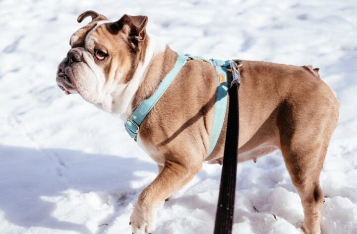
Een hond die een comfortabele tuig draagt tijdens een wandeling in het park, met aandacht voor veiligheid en comfort.

Introduction to Dog Harnesses

Choosing the right equipment for your dog is essential for their safety, comfort, and overall well-being. Among the many dog accessories available today, a comfortable dog harness stands out as an excellent alternative to traditional collars. Not only does it provide better control during walks, but it also reduces strain on your dog’s neck and shoulders. Many pet owners who explore options on sites like dukeandscoop.com find that investing in a well-designed dog harness greatly enhances their pet’s walking experience.

Enhanced Safety and Control

One of the primary benefits of using a dog harness is the increased safety it offers. Unlike collars that apply pressure around the neck, harnesses distribute the force across the chest and shoulders, minimizing the risk of injury, especially for dogs prone to pulling. This distribution helps prevent choking and reduces the likelihood of damage to the trachea or cervical spine.

Additionally, harnesses provide better control over your dog’s movements. This is particularly helpful for training purposes or for managing dogs who tend to be excitable or reactive. Harnesses with front-clip attachments can discourage pulling by redirecting the dog’s attention back toward the owner, making walks more pleasant and manageable.

Comfort and Fit for Every Dog

Comfort is a crucial factor when selecting a dog harness. A harness that fits well will prevent chafing, rubbing, and discomfort, encouraging your dog to wear it without resistance. Many harnesses are designed with padded straps, breathable materials, and adjustable fittings to accommodate various body shapes and sizes.

  • Adjustable straps ensure a snug but comfortable fit, allowing room for movement without slipping off.
  • Soft, breathable fabrics reduce heat buildup and skin irritation during long walks or outdoor activities.
  • Ergonomic designs support natural movement, avoiding restriction in the shoulder and leg areas.

Comfortable harnesses are especially beneficial for puppies, senior dogs, and breeds with delicate necks or respiratory issues.

Supporting Training and Behavior Management

Using a harness can be an effective tool in dog training and behavior management. Harnesses offer better control for teaching your dog how to walk politely on a leash, reducing pulling and lunging behaviors. Some harnesses come with multiple leash attachment points, allowing owners to experiment with different training techniques.

Moreover, a harness can serve as a gentle reminder for your dog to stay calm and focused during walks. By preventing sudden jerks and providing steady control, it helps reinforce positive walking habits while keeping both dog and owner safe.

Additional Benefits for Active and Travel-Friendly Dogs

For dog owners who enjoy outdoor activities or travel, a comfortable harness is an invaluable accessory. It can be used in conjunction with pet travel accessories to secure your dog in vehicles, providing protection in case of sudden stops or accidents. Harnesses also facilitate safe attachment to pet GPS trackers, ensuring your dog’s safety during hikes or explorations.

Furthermore, many harnesses are compatible with other dog accessories such as anti-bark collars and dog toys, enhancing the overall experience for both pets and owners.

Why a Comfortable Dog Harness is a Smart Investment

Investing in a comfortable dog harness is a decision that benefits both the pet and the owner. It promotes better health by reducing the risk of injury, supports effective training, and enhances comfort during daily walks or longer adventures. With the wide variety of options available today, including those found at worldwide pet shops like dukeandscoop.com, pet owners can find harnesses tailored to their dog’s specific needs and lifestyle.

Enhancing Your Dog’s Life Step by Step

Ultimately, a comfortable dog harness is more than just an accessory—it is a tool that fosters a stronger bond between you and your dog while promoting safety, comfort, and well-being. By choosing the right harness, you help ensure that your dog enjoys every walk and adventure with confidence and ease.

Continue Reading

Airdrie’s weather elements

heaven-2627906_640

A charming city with a rich history, Airdrie is known for its unique climate that evolves throughout the year. Understanding the average temperature and precipitation patterns can help not only in planning daily activities, but also in making long-term plans, such as vacations or gardening projects. The weather in Airdrie changes through the seasons, with each season having its own characteristics and surprises. Knowing these patterns offers residents and visitors valuable insights into what to expect during their stay in this beautiful region.

Seasonal temperature patterns

Temperatures in Airdrie vary considerably throughout the seasons. In the winter months, temperatures can drop to around -5°C on average, making for a cold and sometimes snowy landscape. Spring brings mild temperatures ranging from 5°C to 15°C, marking a period of renewal and growth. The summer months in Airdrie are pleasantly warm, with average temperatures ranging from 15°C to 25°C, which is ideal for outdoor activities. Autumn cools to an average of 5°C to 15°C, with a colorful backdrop of falling leaves.

Precipitation patterns in winter

Winter in Airdrie brings not only cold but also a significant amount of precipitation. On average, there is about 60 mm of precipitation per month during the winter months, often in the form of snow. This snow cover can vary depending on specific winter conditions, but adds to Airdrie’s beautiful winter atmosphere. It is a good idea to be prepared for winter conditions by considering appropriate clothing and winter tires for vehicles.

Spring

Spring in Airdrie is a time of transition, with increasing temperatures and changing precipitation patterns. On average, Airdrie receives about 40 mm of precipitation per month in the spring, which consists mainly of rain, although occasional snow showers are possible. The mild temperatures and moderate precipitation promote the blooming of flowers and germination of plants, making it a great time for gardening and outdoor activities. The transition from winter to spring offers a refreshing contrast and makes Airdrie attractive to nature lovers.

Summer

Summer in Airdrie is generally warm and relatively dry. Average precipitation during the summer months is about 30 mm per month, often in the form of light showers or brief rain storms. The higher temperatures of summer make it a popular time for outdoor activities such as hiking, biking and festivals. The longer days and sunny weather contribute to a lively atmosphere in the city and provide plenty of opportunities to enjoy the surroundings.

Autumn

Autumn in Airdrie brings a combination of cool temperatures and increasing precipitation. On average, there is about 50 mm of precipitation per month in autumn, mostly as rain. Temperatures drop to an average of 5°C to 15°C, making for a comfortable, cool atmosphere. Autumn is also the season of beautiful coloring leaves and a good time to enjoy the natural landscape. The change in precipitation and temperature makes autumn a unique season in Airdrie, perfect for a quiet walk in nature.

Annual averages and climate overview

The annual weather in Airdrie shows a temperate climate with distinct seasonal variations. Average annual precipitation is about 500 mm, distributed throughout the year with the highest amounts in autumn and winter. The average annual temperature is around 10°C, with marked differences between the seasons. This diverse climate creates a variety of weather conditions that make each season unique. Knowing these average patterns helps residents and visitors be better prepared for what Airdrie has to offer each season.

Conclusion

Understanding the average temperature and precipitation patterns in Airdrie provides valuable information for anyone living in or visiting the region. Each season brings its own unique weather conditions, from cold winters and snow to hot, dry summers. By knowing these patterns, residents and visitors can better adjust their plans to weather conditions and enjoy all that Airdrie has to offer to the fullest.

Continue Reading